

District Profile
ESTABLISHMENT : 18.12.1972
(Partition of old Shahabad District and formation of Bhojpur and Rohtas)
GEOGRAPHICAL LOCATION:
Latitude: 25015'N to 25046'N
Longitude: 84045'E to 85015'E
Altitude: 195.98 M above MSL
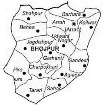
GEOGRAPHICAL BOUNDRY:
North: River Ganga, Saran &Baliyan district
South: Rohtas and Gaya district
East: River Sone and Patna district
West: District Buxar
GEOGRAPHICAL AREA:
2337.37 (sq km.) or 233729.15 (ha)
AGRO-CLIMATIC REGION & ZONE
The district comes under South Bihar
Old Alluvial Plains, which has been categorized as Grade III (Sub-humid). The Soil type is heavy to sandy clay.
Rainfall data (m.m.)
Normal : 959.9 mm
Actual : 817.92 mm
II. Temperature : Min. 60C; Max.400C
III. Relative Humidity: 35 to 950/0
NO. OF BLOCKS/VILLAGE
(a) No. of Blocks : 14
(b) No. of Village Panchayat : 228
(c) No. of Village-Inhibited : 999
(d) No. of Village-Non-Inhibited : 218
(e) No. of Village Electrified : 426
POPULATION (AS PER CENSUS):
| S.N. | Males | Female | Total | |
|---|---|---|---|---|
| 1 | Urban | 169,535 | 142,879 | 312,414 |
| 2 | Rural | 1,010,076 | 920,654 | 1,930,730 |
| Total | 1,179,611 | 1,063,533 | 2,243,144 |
(b) Population density/sq km. : 903
(c) Population below poverty line : 42.50/0
PERCENTAGE OF POPULATION W.R.T. VARIOUS PARAMETERS
| S.N. | Parameter | Total | Rural | Urban |
|---|---|---|---|---|
| 1 | Literacy rate : Persons | 58.96 | 56.84 | 71.55 |
| Male | 74.29 | 73.43 | 79.55 | |
| Female | 41.80 | 38.50 | 62.36 | |
| 2 | Main workers: Persons | 21.93 | 22.07 | 21.07 |
| Male | 36.78 | 36.85 | 36.41 | |
| Female | 5.45 | 5.85 | 2.87 | |
| 3 | Marginal workers: Persons | 7.22 | 7.97 | 2.57 |
| Male | 7.31 | 7.96 | 3.43 | |
| Female | 7.12 | 7.98 | 1.55 | |
| 4 | Non- workers: Persons | 70.85 | 69.96 | 76.36 |
| Male | 55.91 | 55.19 | 60.16 | |
| Female | 87.43 | 86.16 | 95.58 | |
| 5 | SC Population: Persons | 15.32 | 16.22 | 9.76 |
| Male | 15.38 | 16.33 | 9.71 | |
| Female | 15.25 | 16.10 | 9.81 | |
| 6 | ST Population: Persons | 0.37 | 0.37 | 0.39 |
| Male | 0.38 | 0.38 | 0.39 | |
| Female | 0.36 | 0.36 | 0.40 |
CLASSIFICATION OF WORKERS
| S.N. | DETAILS | NUMBER |
|---|---|---|
| 1 | Total Cultivators | 227049 |
| 2 | Small & marginal farmers | 221535 |
| 3 | Agricultural laborers | 259482 |
| 4 | Artisans | NA |
| 5 | Workers in household industries | 24476 |
| 6 | Allied Agro Activities & Other works | 144028 |
| 7 | Total working Population | 655935 |
| 8 | 0/0 of working Population to Total Population | 29.150/0 |
| Size of Land holding | No. of holding | (%) | Area (ha) | (%) |
|---|---|---|---|---|
| (a) Less than 1 ha. | 203840 | 78.9 | 67416 | 35.8 |
| (b) Between 1 and 2 ha | 30498 | 11.8 | 38531 | 20.5 |
| (c) Between 2 and 4 ha | 18454 | 7.1 | 49380 | 26.2 |
| (d) Between 4 and 10 ha | 5324 | 2.0 | 31511 | 16.7 |
| (e) More than 10 ha | 88 | 0.2 | 1296 | 00.8 |
| TOTAL | 258204 | 188134 |
LAND UTILIZATION PATTERN
| a | Geographical area | 2, 33,729.15 ha. |
|---|---|---|
| b | Net cultivable area | 1, 88,134.00 ha. |
| c | Permanent Fallow land | 418.00 ha. |
| d | Cultivable Barren land | 729.00 ha. |
| e | Land temporarily used for non-agriculture purpose | 925.00 ha. |
| f | Pasture & others | 288.00 ha. |
| g | Land not suitable for cultivation | 7221.00 ha. |
| h | Aquatic land | 4071.00 ha. |
| i | Land used for non-agriculture purpose | 31943.00 ha. |
| j | Forest area | Nil |
IRRIGATION SOURCES
Canal : - Sone Canal Circle, Ara.
Sone Canal Division, Bikramganj
State Tube well - 337 (63 functional)
Private Tube well - 18,901
E.R.P. Set - 09
Lift irrigation - 29
Net Irrigate Area
| S.N. | Source | Kharif Area (ha) | Rabi Area (ha) |
|---|---|---|---|
| 1 | Canal | 72952 | 29700 |
| 2 | Private Tube well | 24478 | 36717 |
| 3 | Lift Irrigation | 838 | 153 |
| 4 | State Tube well | 454 | 526 |
| 5 | Other Sources | 1685 | 1685 |
| Total | 1,00,407(ha) | 68,781 (ha) |
AREA COVERED UNDER DIFFERENT CROPS
| Kharif | Rabi | Summer (ha) |
|---|---|---|
| Rice - 1,20,500 | Wheat - 1,03,800 | Green Gram - 20 |
| Maize - 7,000 | Maize - 2,295 | Maize - 30 |
| Pulses - 5,580 | Pulse - 42,600 | Vegetable - 400 |
| Red Gram - 3,500 | Gram - 20,500 | Onion - 125 |
| Black Gram - 1,000 | Pea - 2,500 | |
| Green Gram - 1,080 | Others - 4,500 | |
| Oil Seed - 525 | Oil seed - 10,140 | |
| Sesame - 215 | Rabi/Mustard - 6,100 | |
| Castor - 285 | Sunflower - 40 | |
| Sunflower - 25 | Vegetable - 2,000 | |
| Vegetable - 750 | Potato - 3,525 | |
| Total - 1,34,355 | 1,64,360 | 575 |
CREDIT SYSTEM
| Lead Bank | Punjab National Bank |
|---|---|
| P.N.B. | 22 |
| S.B.I. | 08 |
| Allahabad Bank | 01 |
| C.B.I | 01 |
| Canara Bank | 03 |
| Bank of India | 02 |
| Union Bank | 03 |
| U.C.O. Bank | 02 |
| Indian Bank | 02 |
| United Bank | 01 |
| Bank of Baroda | 02 |
| Syndicate Bank | 01 |
| Madhya Bihar Gramin Bank | 53 |
| Central Co-operative Bank | 15 |
| Land Development Bank | 05 |
| Total | 122 |
AGRIL. MACHINES
| Tractor | 1623 |
|---|---|
| Diesel Pump Set | 15057 |
| Harvester | 05 |
| Electric Pump Set | 1870 |
| Harrows | 360 |
| Winnower | 25 |
| Z T Machines | 2434 |
| Power Tiller | 60 |
| Sprayer & Duster | 676 |
| Ripper | 6 |
| Rotavetor | 25 |
| Thrasher | 425 |
AGRICULTURE SUPPORT / FACILITIES
a) Seed / Fertilizer / Pesticides depots: 103
(b) Rural Markets / Mandis: 91
(c) Rural God owns: 06
(d) Cold Storage: 3 - capacity - 10000 MT.
ANIMAL HUSBANDRY (AS PER 2005 CENSUS)
| Dairy Animals | Total | Milking |
|---|---|---|
| Cow | 157479 | 4279 |
| Buffalo | 206945 | 66068 |
| Plough Animals | 87852 | |
| Sheep + Goat + Pigs | 43698 + 134142 + 17097 | |
| Poultry | 215459 |
PREDOMINANT ECONOMIC ACTIVITIES OF THE DISTRICT
Agriculture is the predominant economic activity in the district. Other important economic activities are dairy, horticulture, transport, housing, business and other activities in the service sector. The industrial activity in the district is in problem state. Most of the industrial units have become sick and good entrepreneurs and businessmen are shifting to other states.
MAJOR FOOD CROPS / COMMERCIAL AND PLANTATION / HORTICULTURE CROPS
- The major food crops of the district are paddy and wheat. Pulses, oilseeds and maize are also important crops.
- However, potato, onion and vegetable have emerged as major commercial horticultural crops.
- Medicinal and aromatic plants have also started taking roots on a small scale, in the district.
- Mushrooms, Quell, Apiculture is now getting momentum.
SPECIAL FEATURE OF THE DISTRICT
- Bhojpur is considered as the rice-bowl in the state and Rice- Mill is a traditional industry.
- Land is fertile and the farmers are comparatively progressive.
- Climate of the district is conducive for a wide ran agricultural / horticultural crops.
- Medicinal and aromatic plants are already being cultivated in the district.
- There are well developed vegetable clusters.
- Dairy infrastructure is well developed.
- The level of farm mechanization is better than many other districts.
- Ara, the headquarter town of the district, is well connected both by rail and road.
- It is an adjoining district of the state capital.
- All the necessary inputs required for Farm as well as Non-Farm activities are available in the district or those can be easily obtained from the adjoining district at competitive price.
- The district hasgood potential for development in Primary, Secondary as well as in Tertiary sectors.
OTHER FACTORS AFFECTING THE DISTRICT'S RURAL ECONOMY
POSITIVE FACTORS
- District headquarter is well linked with other towns and cities by road and rail.
- There is a vast network of canals in the district.
- Two major rivers flow through the district providing a good source of river in fishery and an opportunity to do the sand business.
- A new power grid was commissioned during the year 2004-05 with which the power position in the district has improved a lot.
- The district had been identified under the Rastriya Sam VikasYojana and some of the infrastructural bottlenecks, in terms of rural connectivity, energisation etc, had been bridged.
NEGATIVES FACTORS
- Bhojpur is a drought prone district.
- The rural connectivity and rural infrastructure requires lot of improvement.
- A significant portion of land is rain fed.
- The condition of credit supply is not on need based.